ICESat-2 launches to measure polar ice
What’s happening to the Antarctic ice-sheet? How quickly is it melting and by how much? A couple of days ago NASA launched ICESat-2 which will allow scientists to get a clear picture of ice-sheet loss at both poles – and the potential sea-level rises this will cause. The technology on board can measure changes in height of the ice to within 4 millimetres! You can read the NASA announcement here or see the liftoff and get a quick briefing from this Euronews item.


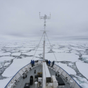
 Photo prise le 20 janvier 2016 dans la mer de Ross, bordant l’Antarctique. PHOTO / Samuel Blanc / Biosphoto / via AFP


Leave a Reply
Want to join the discussion?Feel free to contribute!